Highgreen
2013
Wall drawing, C-Type prints and mixed media objects
Dimensions variable
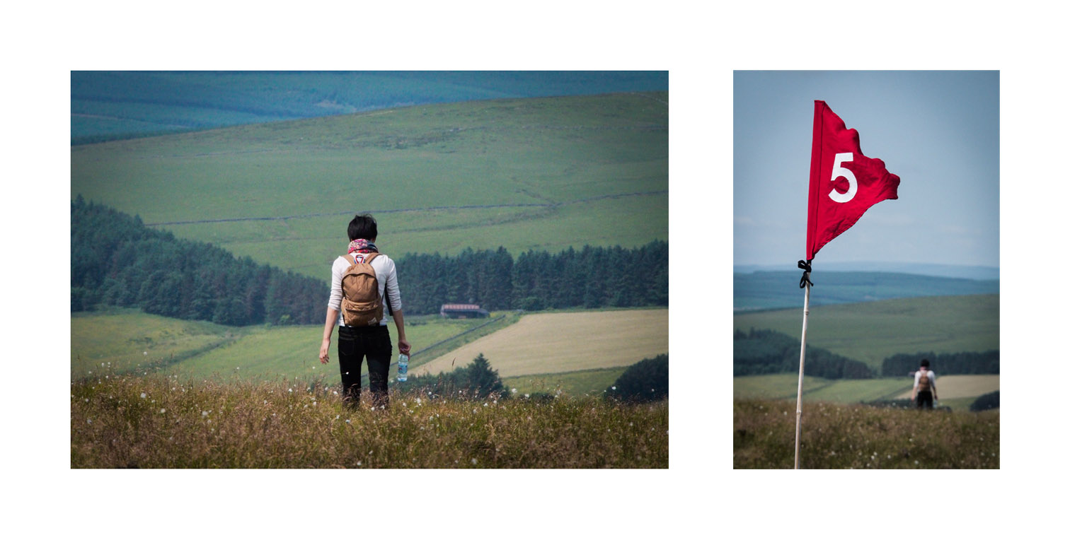
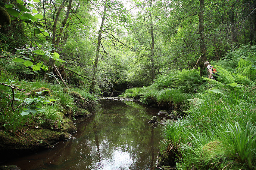
Path
of Least Resistance
acted
as a mechanism to dictate people's routes, walking in an unknown,
uncharted way. Whilst the starting points and the finish were known,
the route was directed by a set of rules and the landscape itself.
Participants
walked as if they were water running off the land, trying to find its
way down to the sea pulled by gravity. Departing from different
starting points along the valley's watershed, set out equally and
marked with numbered flags. Initially the walkers took their own
diverse paths of least resistance, steadily working their way
downhill. However as the walk developed they dropped into the same
folds in the landscape, joining in various valleys, following streams
downhill until they all meet at the finish point - the confluence of
the two rivers marked with further flags.
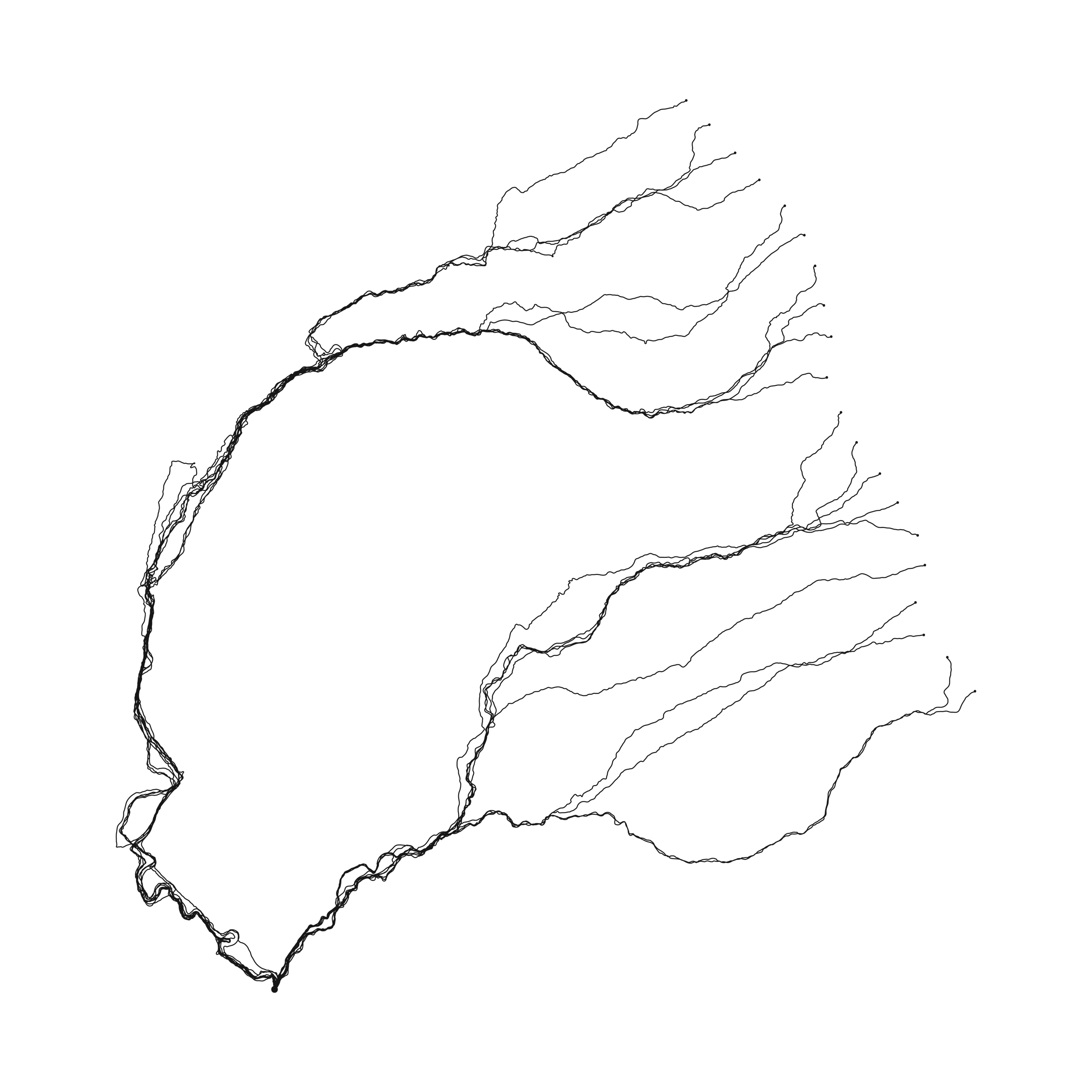
Each
individual carried a GPS logger that recorded their path. This data
was then used to create a drawing built up of the multiple tracks,
revealing the nature of the landscape and the participants adherence
to the rules.
Path
of Least Resistance was Commissioned by VARC as part of Art-Walking.


